


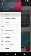
Mobile Topographer GIS


Beschrijving van Mobile Topographer GIS
De geliefde keuze van de professionals,
Mobiele Topograaf ... meets ...
GIS .
U kunt nu een volledig overzicht te voeren zonder enige beperkingen in complexiteit en omvang van de gegevens.
Probeer nu Mobile Topograaf GIS met behulp van de drie dagen gratis proefperiode. Gewoon downloaden van de app en ga verder met hem abonnement procedure. Hoewel, wordt u gevraagd om factuurgegevens te verstrekken, zult u niet in rekening worden gebracht voor het einde van de drie dagen van de gratis proefperiode. U kunt uw abonnement op elk moment tijdens de drie dagen proefperiode annuleren, gratis. Kosten zal alleen gebeuren, als aan het eind van de drie dagen dat je nog steeds een actief abonnement.
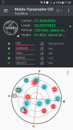
- Verzamel GNSS metingen met behulp van een grotere nauwkeurigheid (GPS, GLONASS, Galileo, Beidou, ondersteund QZSS sterrenbeelden).
- Sluit uw externe GNSS-ontvanger via Neplocaties en gebruik Mobile Topogrpaher GIS als een verwerkingseenheid.
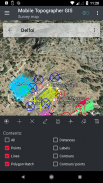
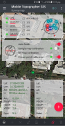
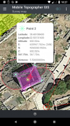
- Display gegevens in WGS84 of u kunt lokale geprojecteerd CRS.
- Omzetten van WGS84 naar lokale geprojecteerd CRS en vice versa.
- Real-time projectie op de kaart.
- *** NEW *** Aangepaste afbeelding of WMS-server op de kaart achtergrond.
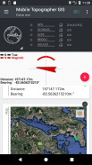
- Zoek een gemarkeerd punt in de echte wereld met behulp van "Drive me"
- Bereken Orthometrische hoogte on the fly met behulp van EGM model of lokale verhoging roosters voor zover beschikbaar.
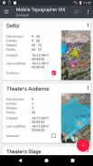
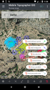
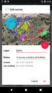
- Organiseer uw werk in Points - Shapes - Entiteiten en onderzoeken. U kunt nu afzonderlijke punten, multi-point groepen, multipart polylijnen, en multipart polygonen met gaten.
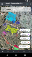
- Maak een volledige tekening met zo gedetailleerd als u wilt.
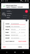
- *** NEW *** geodetische instrumenten. Voeg indirecte punten via een van de volgende opties: 1 punt + Afstand + Azimuth, 2 punten + Afstanden + Select, 2 punten + Azimuts, 3 punten + Afstanden, Middelpunt van de lijn, Divide lijn, Extend lijn, parallelle lijn, loodrecht op lijn .
- Nest uw opdrachten in ieder nestniveau, om een super-enquête te creëren.
- Deel gegevens tussen twee banen met actieve links.
- Exchange jobs tussen uw mobiele apparaat en uw desktop computer, met import - export functies met behulp van alle gangbare formaten .txt, .csv, .kml, .gpx, DXF en Shape-bestanden (SHP - .shx - DBF)
- Samenwerken met uw partners door het uitwisselen en delen van het ene punt naar opdrachten uit te voeren.
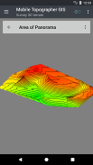
- Maak de 3D-terrein van een gebied door gewoon wandelen doorheen.
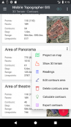
- Bereken contouren en voeg ze toe aan uw enquête met bliksem snelheden.
- Bekijk een echte 3D-model direct in uw apparaat.
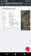
- Bewaar een route met zijn gegevens.
- Toon GNSS satellieten met een signaal info in beide kompasweergave of AR.
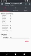
- Back-up en herstellen van uw gegevens met behulp van een SQL db-bestand.
Welkom op het tijdperk van de mobiele landmeten ...!
Meer over Mobile Topograaf GIS vinden in:
http://applicality.com/projects/mobile-topographer-gis/
Download de handleiding van:
http://applicality.com/app_documentation/web/MobileTopographerGIS_Manual.pdf
Mobile Topographer GIS - versie 6.0.15
(23-06-2023)

Mobile Topographer GIS - APK-informatie
APK-versie: 6.0.15Pakket: com.applicality.mobiletopographergisNieuwste versie van Mobile Topographer GIS
Andere versies


 4.34
4.34


Apps in dezelfde categorie

Mogelijk vind je dit ook leuk...


